Annotation: This article presents a comparative analysis of the geography of archaeological and sacred sites in Zhetysu and the Pavlodar Irtysh Region within the context of preserving Kazakhstans natural and cultural heritage. It examines the spatial organization of these sites, the influence of natural and geographical factors on the formation of sacred landscapes, and the general patterns of their development. The study identifies both common features shaped by the traditions of nomadic culture and regional differences determined by environmental conditions. It concludes that a comprehensive historical and geographical approach is essential for the study and preservation of Kazakhstans cultural heritage.
Keywords: archaeological sites, sacred sites, sacred geography, cultural landscape, Zhetysu, Pavlodar Irtysh Region, natural and cultural heritage, spatial analysis, cultural heritage preservation.
The study and interpretation of archaeological and sacred sites within the context of cultural landscapes remain key areas of contemporary historical geography and cultural studies. In recent decades, sustained interest has emerged in the spatial aspects of ancient and traditional cultures. This reflects a shift from examining monuments in isolation to analysing them comprehensively as elements of an integrated system of interaction between people and the natural environment. In this context, particular importance attaches to the study of regions with a high concentration of archaeological sites, where the natural landscape serves not merely as a backdrop but also as an active factor shaping cultural practices and sacred beliefs.
Zhetysu, one of the oldest centres of settlement and cultural development in Kazakhstan, is distinguished by a considerable diversity of archaeological monuments. These include petroglyphs, burial mound complexes, and sacred places associated with traditions of venerating natural features. The spatial organisation of these sites reveals a consistent relationship with topography, the hydrographic network, and natural landscapes. Within the cultural landscape framework, they can therefore be understood as the outcome of long-term interaction between people and their environment. The sacralisation of individual elements of the natural environment – mountain ranges, rock formations, and water sources – constitutes an essential mechanism for preserving cultural memory and shaping symbolic space.
Similar processes can also be observed in other regions of Kazakhstan, particularly in the Pavlodar Irtysh region. Here, archaeological heritage consists primarily of burial mound complexes, prehistoric occupation sites, and individual sacred sites associated with the natural characteristics of steppe and river landscapes. Despite substantial differences in the physical geography of Zhetysu and the Irtysh region, including the contrast between mountainous terrain and steppe plains, both regions exhibit similar principles governing the location and use of archaeological and sacred sites. This suggests the existence of common patterns in the occupation of space and the formation of sacred geography, shaped both by natural factors and by the traditional worldviews of nomadic societies.
In the Pavlodar Irtysh region, archaeological and sacred sites are closely linked to the natural characteristics of steppe and river landscapes, particularly the Irtysh River. The physical geographical differences between Zhetysu and the Irtysh region are considerable: mountainous terrain predominates in the former, while steppe plains characterise the latter. Nevertheless, similar principles governing the location and use of archaeological and sacred sites can be traced in both regions. This suggests shared patterns in the occupation of space and the formation of sacred geography, determined by both nature and the traditional worldviews of nomadic societies.
A comparison of these regions is particularly relevant. It allows research to move beyond local descriptions and identify broader cultural, historical, and geographical patterns. This approach is consistent with contemporary interdisciplinary trends linking archaeology, historical geography, and cultural anthropology. Amid growing interest in preserving cultural heritage and integrating it into contemporary sociocultural practices, analysing the spatial organisation of sacred and archaeological sites has both academic and practical significance.
Furthermore, recent years have seen increasing attention to the interpretation of sacred landscapes in relation to regional identity and historical memory. In this respect, Zhetysu and the Pavlodar Irtysh region provide two distinct yet complementary examples of the formation of cultural space. In each, natural conditions, historical processes, and the population’s traditional beliefs have produced distinctive models of territorial sacralisation. Comparing these models makes it possible not only to clarify the characteristics of each region but also to identify universal mechanisms of interaction between people and landscapes within nomadic civilisation.
The geographical distribution of sacred and archaeological sites in Zhetysu demonstrates a close relationship between the cultural practices of ancient populations and the region’s natural landscape conditions. Zhetysu, also known as Semirechye, encompasses the valleys of the Ili, Karatal, and Aksu rivers and the foothills of the Northern Tian Shan. It constitutes a distinctive area in which sacred geography developed under the influence of both ecological factors and the worldviews of ancient societies [1].
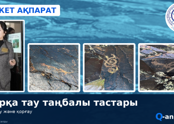
Petroglyphs are among the most representative types of archaeological monuments in the region. They are generally located in areas of pronounced rocky relief – in gorges, on mountain slopes, and near water sources. Major petroglyph complexes, including Tamgaly and Eshkiolmes, are situated in transitional landscapes at the boundary between steppe and mountains. This may reflect their ritual significance as “liminal” spaces [2]. The selection of such locations was determined not only by the availability of rock surfaces but also by their symbolic function: mountains were perceived as sacred axes of the world connecting the earthly and celestial realms.
Burial mounds, or kurgans, also exhibit a consistent spatial organisation. They are most frequently situated in river valleys, on terraces, and on elevated ground that makes them visually prominent in the surrounding landscape. Such placement is associated with perceptions of the status of the deceased and the need to mark territory. Large burial mound cemeteries, such as Besshatyr, form entire sacred landscapes in which individual monuments are integrated into a unified system aligned with cardinal directions and natural landmarks.
Sacred places in Zhetysu include both archaeological monuments and natural features, such as sacred groves, springs, and mountain peaks. Their locations often coincide with areas of distinctive natural character, including unique geomorphological formations, watersheds, and places with particular microclimates. These territories functioned as centres of ritual activity, hosting sacrifices, ceremonies, and communal gatherings [2].
The relationship between sacred sites and the landscape is particularly significant and manifests itself in several ways. First, visual prominence is important: sites are positioned so that they can be seen from considerable distances. Second, alignment with natural reference points – mountains, rivers, and cardinal directions – reflects the cosmological beliefs of ancient societies. Third, the incorporation of natural forms, such as rocks and elevated ground, into sacred space demonstrates the integration of natural and cultural elements [3].
Thus, the geography of sacred and archaeological sites in Zhetysu constitutes a complex system in which the natural landscape serves not merely as a backdrop but also as an active factor shaping cultural space. The spatial organisation of petroglyphs, burial mounds, and sacred places reflects the close integration of people and their environment characteristic of traditional Central Asian societies.
The sacred and archaeological landscape of the Pavlodar Irtysh region, in turn, developed through the interaction of the steppe zone of northeastern Kazakhstan and the Irtysh River valley. This interaction determined the distinctive location and use of archaeological sites. The region was an important centre of nomadic cultures during the Bronze Age, Early Iron Age, and medieval period, where sacred practices were closely connected with the physical geographical characteristics of the territory [4].
Burial mounds are the predominant type of archaeological monument in the region. One of the best-known complexes comprises mounds dating to the twelfth–sixth centuries BCE near the present-day village of Irtyshsk. They range from 11 to 25 metres in diameter and reach up to 0.8 metres in height. Niches, pottery, and animal bone remains have been found in the burials. Notably, burial mound cemeteries are concentrated mainly along the course of the Irtysh, reflecting the river’s role as a principal axis of settlement and communication [5].
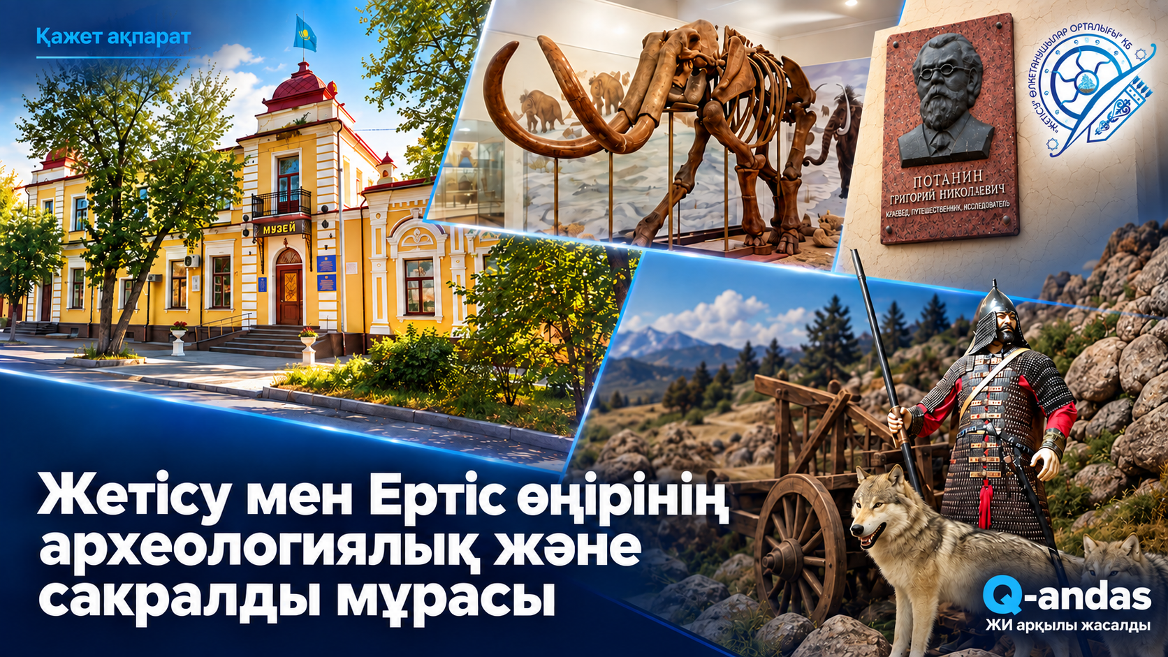
Archaeological investigations in recent years have identified large necropolises dating to the Kimak period, from the ninth to the eleventh centuries CE, in the Kenzhekol and Baydaly areas. Dozens of burial mounds have been recorded there, forming extensive burial fields. These monuments indicate a high population density and a developed social structure among Kimak–Kipchak societies, for which the Irtysh region served as a political and cultural centre (Photo 1).
Photo 1. Reconstruction of a Kimak warrior: clothing, weapons, and protective equipment (ERTIS Museum, Pavlodar).
Early Iron Age monuments, particularly cemeteries of the Tasmola culture, such as the Kyzyltan cemetery, are located mainly in steppe and foothill areas, including the Bayanaul and Ekibastuz regions. This distribution indicates a diversity of cultural traditions and adaptations to different landscape types.
Cult sites in the Pavlodar Irtysh region are less clearly expressed in material terms than those in Zhetysu. Nevertheless, their reconstruction is possible through spatial analysis. Areas containing concentrations of burial mounds, together with prominent natural features such as elevated ground, river bends, and watersheds, may be identified as potential sacred zones. The presence of ancient Turkic artefacts, such as the Irtysh inscription—a bone buckle bearing signs discovered in a burial mound complex—attests to the sacred and communicative functions of these places [6].
The sacred and archaeological landscape of the Pavlodar Irtysh region constitutes a spatially organised system in which burial mounds serve as the principal markers of cultural space, while the Irtysh River valley acts as a structuring element. In contrast to the mountainous areas of Zhetysu, a horizontal model of spatial sacralisation predominates here, associated with the nomadic way of life and steppe ecology.
A comparative analysis of the sacred and archaeological landscapes of Zhetysu and the Pavlodar Irtysh region shows that both share the predominance of burial mound complexes as key elements of sacred space. Burial mounds functioned not only as funerary structures but also as territorial markers reflecting the social stratification of society. In both regions, they are associated with visually significant landscape elements, including elevated ground, river terraces, and open steppe areas.
Differences, however, emerge in the types of sacred sites and their spatial organisation. In Zhetysu, petroglyphs and natural sacred features, located predominantly in mountain and foothill zones, play a significant role. A vertically oriented model of sacred space develops here, with mountains serving as sacred centres. In the Pavlodar Irtysh region, by contrast, a horizontal structure predominates: sacred sites extend along the Irtysh valley, while cult practices are associated with the river system and steppe spaces.
The sacralisation of space in the regions under consideration occurs through the integration of natural and cultural elements. In Zhetysu, sacred space forms around prominent natural features, such as mountains and gorges, which are endowed with mythological significance and become centres of ritual activity. In this context, petroglyphs serve as a means of “establishing” the sacred status of a territory [7].
In the Pavlodar Irtysh region, spatial sacralisation is more dispersed. It is expressed through a system of burial mounds distributed across the territory and forming a distinctive “sacred network”. Here, significance lies less in an individual monument than in the collective arrangement of monuments and their spatial organisation in relation to natural landmarks.
The analysis supports several general conclusions. First, the sacred and archaeological landscapes of Zhetysu and the Pavlodar Irtysh region are shaped decisively by the natural environment, which determines both the types of monuments and their spatial organisation. Second, despite their shared nomadic cultural tradition, the two regions demonstrate different models of spatial sacralisation: vertical in Zhetysu and horizontal in the Irtysh region. Third, differences in the range of archaeological sites—petroglyphs, cult places, and burial mounds—reflect the distinctive cultural practices and worldviews of ancient populations. Zhetysu is characterised by a more pronounced concentration of symbolic and ritual meanings, whereas the Pavlodar Irtysh region is characterised by the structural organisation of sacred space through burial complexes.
Thus, the sacred landscape serves as an integrative category encompassing natural, cultural, and social dimensions, enabling a deeper understanding of the historical development of Kazakhstan’s regions.
References
Russian-language titles are given in English translation.
- Margulan, Alkey Khakanovich. The Ancient Culture of Central Kazakhstan. Almaty: Nauka, 1979.
- Baipakov, Karl. Medieval Cities of Kazakhstan on the Great Silk Road. Almaty, 1998.
- Tilley, C. A Phenomenology of Landscape: Places, Paths and Monuments. Oxford: Berg, 1994.
- Arslanova, F. Kh. Essays on the Medieval Archaeology of the Upper Irtysh Region. Materials and Studies on the Archaeology of Kazakhstan, vol. 3. Astana, 2013.
- Smagulov, Talgat. Archaeological Investigations of the Pavlodar Irtysh Region. Pavlodar, 2021.
- Amanzholov, A. S. Turkic Runic Script. Alma-Ata, 1985.
- Samashev, Zeynolla. Petroglyphs of Kazakhstan. Almaty, 2006.
Frank D.A.
G.N. Potanin Pavlodar Regional Museum of History and Local Lore, Municipal State-Owned Enterprise
dddimm@mail.ru