Abstract: The article examines rock carvings discovered in 2024 during local history fieldwork at the foothills of Mount Marka in the Sarkan District of the Zhetysu Region. The site was documented and photographed at the initiative of Nugmanova I.E. The study aims to describe the petroglyphs, assess their historical and cultural significance, provide a preliminary chronological attribution, and identify priorities for further research and protection. The methods applied include field observation, photographic documentation, iconographic analysis, and comparative typological analysis. The recorded images include anthropomorphic and zoomorphic figures, as well as zigzag and linear signs. Comparison with known petroglyphic traditions of Zhetysu suggests, as a working hypothesis, a possible attribution to the Bronze Age, including the 2nd millennium BCE. A more precise dating requires further study of the archaeological context, patina, carving techniques, and the site as a whole.
Keywords: Zhetysu, Sarkan District, Mount Marka, petroglyphs, rock art, Bronze Age, archaeological site, historical and cultural heritage, heritage preservation.
INTRODUCTION
Zhetysu is one of the regions of Kazakhstan with a particularly high concentration of archaeological sites and historical and cultural heritage. Settlements, burial mounds, ritual sites and rock carvings have survived in its mountain and foothill landscapes. Petroglyphs are an important source of information about the economy, worldview, mythological ideas and relationship with the environment of societies from periods for which written records are scarce or absent [1, 2]. The inscription of the Archaeological Landscape of Tamgaly on the UNESCO World Heritage List demonstrates the international significance of Kazakhstan’s rock art [3].
The petroglyph complexes of Eshkiolmes, Bayan Zhurek and other sites in Zhetysu show that the region’s artistic traditions developed over a long period [2, 4]. In this context, documenting the petroglyphs discovered in the foothills of Marka Tau in Sarkan District can help complete the archaeological map of the region. The site came to attention in 2024 during local history fieldwork initiated by I. E. Nugmanova, a history teacher at Sarkan Polytechnic College. At the initial stage, the images on the rock surfaces were photographed and their visible features recorded.
The dating to the second millennium BCE proposed in this article is not presented as a definitive archaeological conclusion. It is a preliminary scientific hypothesis based on the images’ technique and subject matter, as well as their general resemblance to Bronze Age rock art in Zhetysu. Because petroglyphs are difficult to date accurately from their appearance alone, future research must consider the archaeological context, patina on the rock surface, tool marks, superimposed images and nearby archaeological sites together [1, 5].
RESEARCH AIM, OBJECTIVES AND METHODS
The aim of this study is to provide an initial scientific description of the petroglyphs discovered in the foothills of Marka Tau, identify the typological features of the images, assess their historical and cultural significance, and develop recommendations for studying and protecting the site.
The objectives are to describe the site and its setting; group the main images using the available photographs; identify the features of anthropomorphic, zoomorphic and symbolic elements; conduct a general comparison with well-known petroglyph complexes in Zhetysu; define the limits of a preliminary date; identify threats to the site’s preservation; and propose a sequence of protective measures.
The study uses several methods. Field observation focused on the site’s position in its natural setting and the condition of the rock surfaces. Photographic documentation recorded the images in their current state of preservation. Descriptive and iconographic methods were used to analyse visible forms and compositional elements. Comparative typology was used to compare the Marka Tau material with known examples of rock art from Kazakhstan and Zhetysu [1, 2, 4]. A historical and comparative approach also makes it possible to consider the images in the context of Bronze Age livelihoods and beliefs. The study does not involve invasive methods at this stage. Chemicals must not be applied to the rock, and chalking or mechanical treatment must not be used to make the images more visible.
DESCRIPTION OF THE MARKA TAU PETROGLYPHS
The Marka Tau petroglyphs are located on natural rock surfaces in the foothills. The photographs suggest that the images were made on a dark brown patinated surface using a technique resembling pecking or percussion. Some lines appear lighter, possibly because the surface crust was broken to expose the layer beneath. However, identifying the technique accurately requires macrophotography and direct examination by archaeologists.
The first photograph shows a stylised image resembling a human face. Within a roughly circular outline are depressions resembling eyes and a mouth, while linear elements are visible in the upper part. It would be scientifically premature to identify the image with a specific mythological figure or a “sun-headed” anthropomorph. At present, it is more appropriate to describe it as a stylised image with anthropomorphic features. Interpreting its meaning will require a full record of its relationship to surrounding marks, dimensions, orientation and method of execution.
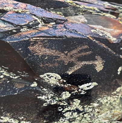
Figure 1 – Stylised image with anthropomorphic features on a rock at Marka Tau. Photograph: I. E. Nugmanova’s field materials, 2024.
The second photograph shows a figure resembling an animal, with an elongated body and a head and legs rendered as lines. Its incomplete preservation makes it difficult to identify the species accurately. Its overall outline resembles a hoofed animal. Mountain goats, deer, argali and other ungulates are common subjects in Kazakhstan’s rock art [1, 2]. Identifying the Marka Tau figure more precisely would require high-resolution study of the horns, body proportions and pecked outline.
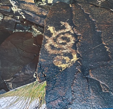
Figure 2 – Zoomorphic image on a rock at Marka Tau. Photograph: I. E. Nugmanova’s field materials, 2024.
The third photograph shows a composition of winding and intersecting lines. These elements cannot be conclusively interpreted as water, a road, a map, a clan mark or an astronomical sign. The meaning of geometric marks in rock art depends heavily on context, and such marks may have served different purposes in different periods. At this stage, the composition should therefore be described as a “winding linear mark”, and its spatial relationship to other images should be recorded.
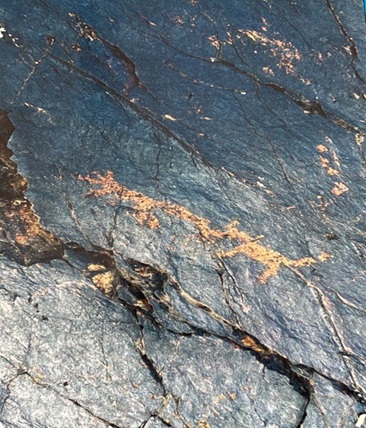
Figure 3 – Winding linear mark on a rock at Marka Tau. Photograph: I. E. Nugmanova’s field materials, 2024.
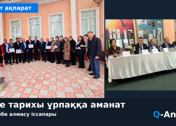
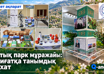
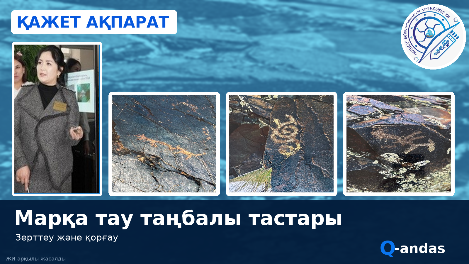
The fourth photograph shows a local history presentation about the site alongside the discovered images. This visual record is useful for documenting the history of the site’s discovery. For a scientific site record, however, each rock panel should be numbered separately. A standardised photographic archive should then be created, including general views, medium-range photographs, close-ups and images with a scale bar.
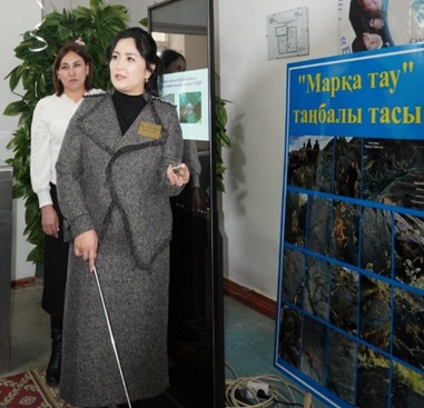
Figure 4 – Local history presentation and photographic materials concerning the Marka Tau petroglyphs, 2024.
PRELIMINARY DATING AND COMPARATIVE ANALYSIS
Animals, anthropomorphic figures, ritual scenes and various marks are widespread in the Bronze Age rock art of Kazakhstan [1, 2]. A substantial proportion of the principal petroglyphs at Tamgaly are associated with the Bronze Age, while its archaeological landscape continued to be used as a sacred and ritual space over a long period [3]. Other complexes in Zhetysu also show that images at a single site may belong to different periods and form multiple layers [4].
The zoomorphic and stylised anthropomorphic images at Marka Tau, together with a technique resembling pecking, provide grounds for comparison with Bronze Age traditions. The second millennium BCE is therefore proposed as a working date. Similarity between individual motifs, however, does not establish an absolute date. Images made in different periods may occur on the same rock surface, and later artists may have reused earlier panels [1, 5].
Several kinds of evidence are needed to refine the date: a complete topographic plan of the petroglyphs; comparative analysis of patina colour and the rock’s microrelief; study of the form of the pecking marks; the sequence of superimposed images; and the surrounding archaeological context, including any nearby settlements, burial mounds, ritual structures or pottery. Only a combined assessment of this evidence can make the dating more reliable.
HISTORICAL AND CULTURAL SIGNIFICANCE AND RESEARCH CONTRIBUTION
The principal scientific value of the Marka Tau petroglyphs is that they add to the known distribution of rock art sites in Sarkan District. If specialised research confirms the integrity and date of the complex, it could provide further evidence for reconstructing the cultural landscape of Zhetysu during the Bronze Age and later periods. Its possible links with mountain passes, grazing areas, water sources and ancient routes are particularly important to investigate.
The site’s historical significance is not limited to the age of its images. The location of the petroglyphs bears witness to a long relationship between people and the natural landscape. Animal images reflect ancient communities’ attention to their surroundings, while anthropomorphic and symbolic motifs point to forms of symbolic thought and communication. Their specific religious or ethnic meanings, however, cannot be stated conclusively without archaeological evidence.
The contribution of this study is to describe systematically, in a single article, the Marka Tau rock images identified during local history fieldwork in 2024; distinguish their principal groups; frame their preliminary date as a scientific hypothesis; and propose a phased programme for research and protection. These materials could serve as an initial evidence base for a future professional archaeological expedition.
RECOMMENDATIONS FOR RESEARCH AND PROTECTION
Stage one – prompt scientific documentation. Each panel should be assigned a provisional number. Its GPS/GNSS coordinates, elevation, orientation, dimensions and state of preservation should be recorded. A general site plan should show every panel, paths, water sources and nearby archaeological features. Photographic documentation should go beyond the 200–300 dpi requirement for print: original images should be preserved at high resolution for the archive.
Stage two – digital documentation. Photogrammetry should be used to create a 3D model, a scaled orthophoto should be prepared, and a GIS database should be established. These methods make it possible to examine the images’ microrelief, damaged areas and changes over time without physically touching them. Where necessary, non-contact imaging methods using variable lighting, such as RTI (Reflectance Transformation Imaging), may also be used.
Stage three – archaeological assessment and dating. Qualified archaeologists should study the panels’ execution technique, patina, superimposed images and surrounding archaeological context. Any sampling or physical intervention must comply with legal requirements and the relevant permits. Until the site’s status has been determined, chalking, painting, wetting, cleaning, retracing and taking impressions from the rock surfaces must be avoided.
Stage four – legal protection. On the basis of the research findings, the site should be proposed for preliminary registration as a historical and cultural heritage property. A scientific site record should be prepared, and the competent authorities should consider its protected status. A protection zone should take account of the natural landscape and potential archaeological context, as well as the rock panels themselves [6].
Stage five – regular monitoring. Repeat photographs should be taken from the same positions at least once a year. Cracks, surface flaking, biological growth, water erosion and damage caused by human activity should be recorded. The monitoring results should be kept in a single electronic log.
Stage six – responsible interpretation and tourism. The site should be included on a tourist route only after scientific assessment and the establishment of a protection regime. An information sign could instruct visitors not to touch the rock, add inscriptions or light fires. If publishing precise coordinates would increase the risk of vandalism, access to them should be restricted. Local history lessons for schools and colleges based on digital 3D models and photographs would reduce pressure on the original site.
CONCLUSION
The petroglyphs discovered in the foothills of Marka Tau in 2024 are an important new source for studying the historical and cultural heritage of Sarkan District. The available photographs make it possible to distinguish an image with anthropomorphic features, a zoomorphic figure and winding linear marks. Comparison of their technique and subject matter with known rock art traditions in Zhetysu supports consideration of a preliminary hypothesis placing them in the second millennium BCE, or the Bronze Age.
The precise age of the site can, however, be established only through professional archaeological research. The priorities at this stage are therefore to document the site fully, investigate its spatial and archaeological context, prepare a scientific site record and ensure its preservation. Bringing the Marka Tau petroglyphs into academic study responsibly would both add to the archaeological map of Zhetysu and deepen understanding of the region’s cultural landscape and the relationship between ancient societies and nature.
REFERENCES
- Samashev, Z. Petroglyphs of Kazakhstan: Questions of Study and Interpretation. – Almaty: Öner, 2006. [In Russian.]
- Maryashev, A. N., and A. A. Goryachev. Rock Images of Semirechye. – Almaty, 2002. [In Russian.]
- UNESCO World Heritage Centre. Petroglyphs within the Archaeological Landscape of Tamgaly. World Heritage List, No. 1145.
- Rogozhinsky, A. E. “Petroglyphs and the Cultural Landscape of Zhetysu: Questions of Chronology and Interpretation.” Archaeology of Kazakhstan. – Almaty. [In Russian.]
- Bednarik, R. G. Rock Art Science: The Scientific Study of Palaeoart. – New Delhi: Aryan Books International, 2007.
- Law of the Republic of Kazakhstan No. 288-VI of 26 December 2019, “On the Protection and Use of Historical and Cultural Heritage Sites.”
- Margulan, A. Kh. The Begazy-Dandybay Culture. – Almaty: Gylym, 1979. [In Kazakh.]
- Scientific and educational materials on petroglyphs published by the Tamgaly State Historical, Cultural and Natural Museum-Reserve. [In Kazakh.]
- Nugmanova, I. E. Field photographic records and local history materials on the Marka Tau petroglyphs. – Sarkan, 2024. – Personal archive.
Nugmanova I. E.
History teacher, Sarkan Polytechnic College
Sarkan, Zhetysu Region, Kazakhstan
E-mail: inkar.esenzhol@bk.ru